Fiber-optical Instrumentation Towed System (FITS)
The FITS (Fiber-optical Instrumentation Towed System), developed by the Institute of Undersea Technology at National Sun Yat-sen University in Taiwan, is equipped with video cameras and acoustic sonars for geological and biological investigation around the methane gas seeps off the coast of southwest Taiwan. With a fiber-optic cable as its backbone, it streams high definition (HD) live video and transmits real-time sensor data to a surface vessel from thousands of meters below sea level. To cover a wider seafloor survey range, the FITS carries a scanning sonar and side scan sonar for seabed feature mapping. In addition, an ultra-short baseline (USBL) positioning system and inertial navigation system (INS) with a Doppler velocity log (DVL) are mounted on the FITS for precise underwater positioning. (Depth rating: 3000 m)
Abyss Twisted-pair Imaging System (ATIS)
The ATIS (Abyss Twisted-pair Imaging System) is developed by the Institute of Undersea Technology at National Sun Yat-sen University in Taiwan, using state-of-the-art sensors and technologies to collect seafloor videos. The ATIS is equipped with a high-resolution video camera, four LED lights, an altimeter, and a depth sensor. The main characteristic of the ATIS is the capability of transmitting live video streams and sensor data from up to 8000 meters in real time through a twisted-pair or coaxial cable. The communication over an 8000 m long twisted-pair or coaxial cable provides a broadband transmission speed of up to 3 Mbps, which enables the ATIS to deliver real-time high-definition (HD) seafloor video with resolutions up to 1920p by 1080p resolution. (Depth rating: 3000 m)
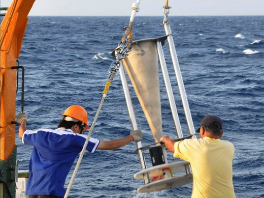
Video-guided Multi-corer (V-Corer)
V-corer (Video guided multi-corer), as opposed to conventional blind corers, is developed to provide visual information of experiment sites to scientists to aid a prompt and accurate decision for collecting coring samples during surveys. V-corer, equipped with a real-time HD camera and lighting, uplinks live images to the surface vessel. This function improves the efficacy of sediment collection significantly as operators can better avoid hard seafloor, which is highly risky for the coring device. The coring device preserves 40 cm worth of sediment beneath the seafloor and several centimeters of supernatant water in the tube. The in-situ images of coring sites provides important cues for the whereabouts of the coring contents. V-corer successfully collected multiple undisturbed sediment samples near the gas plume zone of the methane hydrate reservoirs off southwestern Taiwan. (Depth rating: 3000 m)
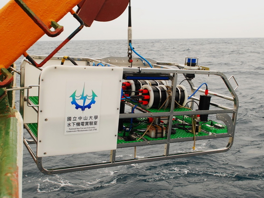
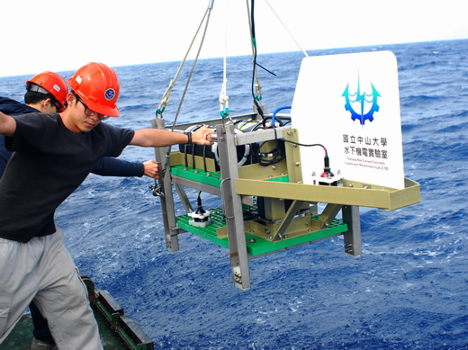
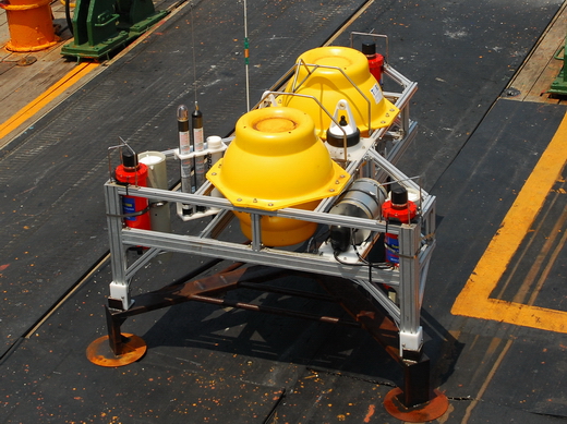
Autonomous Benthic Lander (ABL)
The ABL is an instrument platform suitable for close to seafloor sampling. An onboard MCU (micro control unit) coordinates the power cycles and the operation of individual sensors or samplers. Each sub-system can be preprogrammed to operate within a custom schedule. A dual-anchor release mechanism ensures the drop of four ballast weights on the corners. A smart lithium battery pack is used to provide the electricity needed by all onboard modules with a payload of up to 60 kg. (Depth rating: 5000 m)
Seafloor Acoustic Transponder System (SATS)
The accuracy of GPS/Acoustic positioning is crucial for monitoring seafloor crustal deformation. The SATS was therefore developed to evaluate the accuracy of GPS/Acoustic seafloor positioning. The SATS has three transponders and an attitude sensor in each unit, which provides the true lengths of transponder baselines and true attitude of the SATS to ensure assessment reliability and validity.
Ocean Bottom Seismometer (OBS)
The OBS Yardbird is a joint project by the UML, the Institute of Earth Science, Academia Sinica, and the Taiwan Ocean Research Institute. The goal is to produce an OBS with long operation duration (13 months) and also auto-leveling mechanism to align its sensor axes with the gravity field. The geophone-based sensor with a bandwidth extension circuit can detect seismic signals from 20 s to 40 Hz. Its performance is verified through comparing field data collected in the Okinawa Trough to the nearby Japanese YNG land station. (Depth rating: 3000 m)
Seafloor Laser-line Scanning System (SLSS)
The SLSS projects a line laser on the seafloor and captures the reflection of the laser line with a digital camera. The vertical dislocation of the laser reflection is proportional to the relief of the seafloor. Its sensitivity and resolution are much higher than that of acoustic approaches. This scanning assembly moves on a linear rack to cover an area 300 mm x 500 mm with 0.3 mm resolution in all directions.
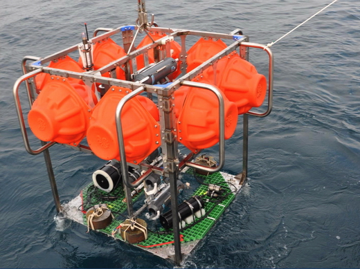
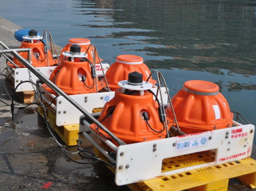
Sediment Trap
This sediment trap uses an ultra-low power control unit to coordinate the rotation of the collection cup rosette. There are twelve 250 CC sample cups. A tall sediment collection cone prevents sediment from resuspension by motion or current disturbance. The total weight of the trap is 35 kg in the air, and 30 kg in the water. Its weight makes it easy for transportation, operation and deployment. (Depth rating: 5000 m)